| Home > All By Location regional map > Pittsbugh East > Highland Park Bridge 1938 | |||
|
|
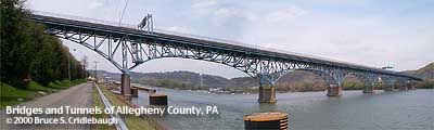
View downstream from Lock & Dam No. 2 access road 
Elevation drawing looking downstream 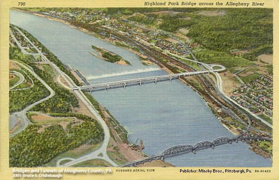
1939 postcard, view downstream OFFICIAL NAME: OTHER DESIGNATION: Highland Park Bridge pghe592-5 LOCATION: Pittsburgh - Aspinwall USGS 7.5" Topo Quad - UTM Coordinates: Pittsburgh East - Zone 17; 0592 4482 CARRIES: motor vehicles, 4 lanes divided, SR1005 BETWEEN: -- ramps to PA28 [Alexander H. Lindsay Memorial Highway] and Freeport Rd [Old PA28] (Aspinwall) on right descending bank of Allegheny River -- ramps to Butler St (Pittsburgh) on left descending bank of Allegheny River CROSSES: -- Allegheny River at mile 6.8 TYPE OF CONSTRUCTION / DESIGN: Steel spandrel braced deck truss LENGTH OF MAIN SPAN: 266 ft (5 spans plus 2 130 ft anchor spans) TOTAL LENGTH (including longest elevated ramp): HEIGHT OF DECK: 50 ft clearance at center Lock and Dam No. 2, Highland Park, normal pool level 721.0 ft YEAR ERECTED / ENGINEER: 1938 ADDITIONAL INFO: Crosses 1/10 mile upstream from Lock and Dam No. 2. A ferry is shown on maps about 2/10 mile upstream from current bridge. Lock and Dam No. 1, built in 1902, was located at 21st St. It was removed when the Emsworth Dam (1922) was built, thus providing the pool for the Pittsburgh Point area up to the Highland Park Bridge area. An earlier Highland Park Bridge is shown on the 1907 USGS map, crossing from near the tunnel under the railroad at 19th St, Sharpsburg, to a landing at Baker St near the western end of the 1914 Heth's Run Bridge (Haight's Run). This older bridge is shown crossing the downstream tip of Six Mile Island, but the streets and island do not align as shown on the USGS map. This seems to indicate that Six Mile Island has moved downstream a distance roughly equal to it present length, so that the upstream tip now lies where the bridge would have crossed. FIELD CHECKED: INFO SOURCES: USACE Allegheny River Nav. Charts Submit info or inquiry - share some facts or ask a question. Introduction -- Nearby Structures Page created: Last modified: 18-Jan-2001 |
View Larger Map 
| |
| copyright: © Bruce S. Cridlebaugh 1999-2008 All Rights Reserved | |||