| Home > All By Location regional map > Pittsbugh East > WPA bridges on Locust Trail | |||
|
|
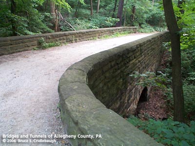
Bridge nearest Blvd of the Allies More detail photos OFFICIAL NAME: OTHER DESIGNATION: WPA bridges on Locust Trail (2 structures) LOCATION: Pittsburgh (Schenley Park) USGS 7.5" Topo Quad - UTM Coordinates: Pittsburgh East - Zone 17; 0589 4776 CARRIES: pedestrians, Locust Trail BETWEEN: -- CROSSES: -- stream TYPE OF CONSTRUCTION / DESIGN: concrete over corrugated steel, stone facing LENGTH OF MAIN SPAN: TOTAL LENGTH (including longest elevated ramp): HEIGHT OF DECK: YEAR ERECTED / ENGINEER: 1939, Works Progress Administration ADDITIONAL INFO: The Locust Trail clings to the hillside below Overlook Drive and above the Penn Lincoln Parkway East. The trail provides the southern section of a circumferential path around the park -- connecting the Anderson Bridge on the west to the four-way intersection of Greenfield, Hobart, Bartlett and Panther Hollow roads in the east. Near the Anderson Bridge, south of the swimming pool, the trail crosses a pair of small ravines which drain into Four Mile Run. Each gap is crossed by a faux-arch bridge with stone facing. The construction includes a section of corrugated steel pipe well concealed below the stonework. The Locust Trail bridges were constructed by the WPA in 1939, as were bridges on the Bridle Path and Lake Trail in the center of the park. The Locust Trail is a well-travelled, well-maintained trail used by pedestrians and bicyclists. Above the Parkway, the trail is cut into the hillside. The stone cliffs in this area suggest that this could have been the source of the stone for the Schenley Park WPA bridges. view page - More information about the WPA bridges on the Lake Trail, plus info about the WPA. FIELD CHECKED: 03-Jul-2004 INFO SOURCES: Submit info or inquiry - share some facts or ask a question. Introduction -- Nearby Structures Page created: Last modified: 06-Jul-2004 |
View Larger Map 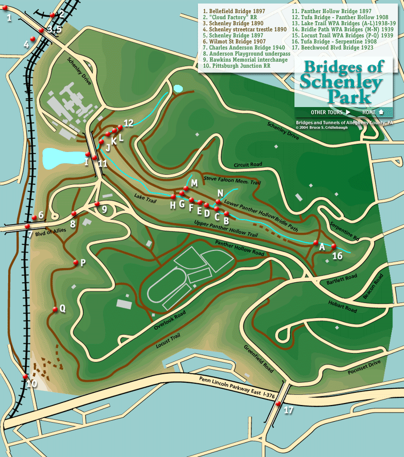

| |
| copyright: © Bruce S. Cridlebaugh 1999-2008 All Rights Reserved | |||