| Home > All By Location regional map > Pittsbugh East > Veterans Bridge | |||
|
|
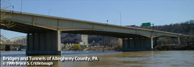
View east from North Shore (downstream right) 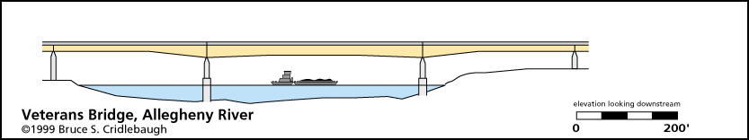
Elevation drawing looking downstream More detail photos OFFICIAL NAME: Veterans Bridge OTHER DESIGNATION: pghe585-17 LOCATION: Pittsburgh USGS 7.5" Topo Quad - UTM Coordinates: Pittsburgh East - Zone 17; 0585 4477 CARRIES: Interstate 579 - seven lanes wide (three lanes northbound, one lane reversible High Occupancy Vehicle [HOV-2], three lanes southbound) BETWEEN: -- between Madison Ave and Warfield St on right descending bank of Allegheny River; connects to I-279 [East Street Valley Expressway] and PA28 [East Ohio St] -- between 13th and 14th St on left descending bank of Allegheny River; connects to Crosstown Blvd [I-579] CROSSES: -- (RDB to LDB) Progress St; River Rd; Allegheny River at mile 1.1; Smallman St; Mullberry Wy; Penn Av; Liberty Av; Conrail; Martin Luther King Jr. Memorial East Busway TYPE OF CONSTRUCTION / DESIGN: Steel, welded girder LENGTH OF MAIN SPAN: 410 ft clear span TOTAL LENGTH (including longest elevated ramp): 1050 ft HEIGHT OF DECK: 51.0 ft Emsworth Dam normal pool level 710 ft YEAR ERECTED / ENGINEER: 1986-87, PennDOT PennDOT, current owner ADDITIONAL INFO: Required the removal of a section of the roof of the former Pennsylvania Railroad freight building on Liberty Av at 12th St. The final missing link in Crosstown Blvd [I-579], ramps were also originally planned to link to Ft Duquesne Blvd. Although plans have been discussed, there is no direct connection to the North Shore Expressway, which means that this bridge skirts the eastern edge of the North Side while offering no entrances or exits for the area. North Side traffic must use the Three Sisters suspension bridges or the Ft Duquesne Bridge. Some motorists use the PA28 north exit and make a very dangerous and illegal U-turn at the end of the divided highway. FIELD CHECKED: INFO SOURCES: USACE Allegheny River Nav. Charts Submit info or inquiry - share some facts or ask a question. Introduction -- Nearby Structures Page created: Last modified: 06-May-2002 |
View Larger Map 
| |
| copyright: © Bruce S. Cridlebaugh 1999-2008 All Rights Reserved | |||