| Home > All By Location regional map > New Kensington West > C. L. Schmitt Bridge | ||||
|
|
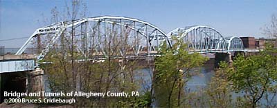
View from Freeport Rd 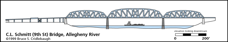
Elevation drawing looking downstream
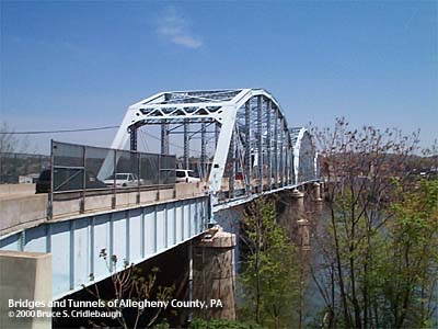
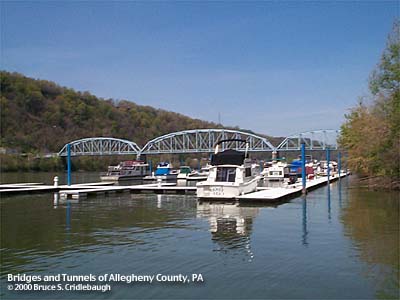
OFFICIAL NAME: C. L. Schmitt Bridge OTHER DESIGNATION: New Kensington Bridge, Ninth Street Bridge nknw603-13 LOCATION: West New Kensington (Frazer Twp., Allegheny Co.) - New Kensington (Westmoreland Co.) USGS 7.5" Topo Quad - UTM Coordinates: New Kensington West - Zone 17; 0603 4490 CARRIES: motor vehicles, 2 lanes [Orange Belt], SR1038 BETWEEN: -- Freeport Rd [old PA28] (West New Kensington, Frazer Twp., Allegheny Co.) on right descending bank of Allegheny River -- Ninth St, intersecting with Industrial Blvd (New Kensington, Westmoreland Co.), on left descending bank of Allegheny River CROSSES: Allegheny River at Mile 19.0 TYPE OF CONSTRUCTION / DESIGN: Parker Pratt through truss LENGTH OF MAIN SPAN: 350.0 ft clearance channel span TOTAL LENGTH (including longest elevated ramp): 1510 ft HEIGHT OF DECK: 49.8 ft clearance Lock and Dam No. 3, Acmetonia, normal pool level 734.5 ft YEAR ERECTED / ENGINEER: 1927 PennDOT, current owner ADDITIONAL INFO: The bridge is named for the late C. L. Schmitt of New Kensington who served in the Pennsylvania State Legislature for 16 years. He served for the 54th District and is noted for working to establish the PA Consumer Credit Act, a model for the Federal Truth in Lending Law. FIELD CHECKED: 27-Apr-2000 INFO SOURCES: field check; USACE Allegheny River Nav. Charts, Jim Schmitt for PA Congress website Submit info or inquiry - share some facts or ask a question. Introduction -- Nearby Structures Page created: Last modified: 02-May-2000; 29-Feb-2016 |

| ||
| copyright: © Bruce S. Cridlebaugh 1999-2016 All Rights Reserved | ||||