| Home > All By Location regional map > Murrysville > Old Leechburg Rd over Little Plum Creek | ||||
|
|
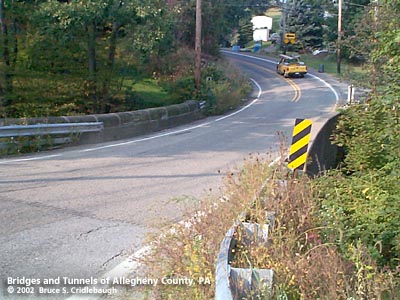
View east (upstream to right) toward New Texas Rd
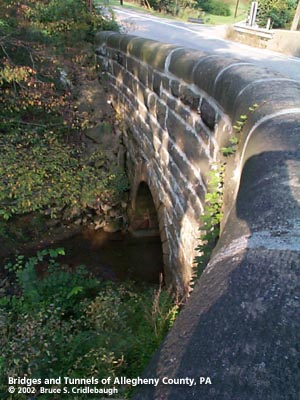
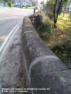
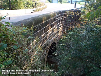
OFFICIAL NAME: OTHER DESIGNATION: Old Leechburg Rd over Little Plum Creek murr605-2 LOCATION: Plum USGS 7.5" Topo Quad - UTM Coordinates: Murrysville - Zone 17; 0605 4483 CARRIES: -- Old Leechburg Rd BETWEEN: -- west of intersection at New Texas Rd [Orange Belt] CROSSES: -- Little Plum Creek TYPE OF CONSTRUCTION / DESIGN: stone arch locally-quarried sandstone outer spandrel wall: rock-faced coursed ashlar upper walls and parapets: dressed coursed ashlar arch ring: dressed voussoirs in semicircular arch South arch face and parapet rebuilt with concrete LENGTH OF MAIN SPAN: 11 ft TOTAL LENGTH (including longest elevated ramp): 33 ft 19.5 ft wide, between parapets HEIGHT OF DECK: YEAR ERECTED / ENGINEER: 1900, Allegheny County Charles Davis, county engineer ADDITIONAL INFO: This bridge exhibits the more common design features of the County's stone bridges -- parapets with rounded top and horizontal curves at the portals. This bridge shows unusual proportions compared to the many other of its type in the county. The relatively short 11-foot span is countered with tall outer walls -- approximately 30 feet from base to parapet. Typically these bridges are longer than they are tall. The downstream wall has been rebuilt in concrete. FIELD CHECKED: 01-Oct-2002 INFO SOURCES: field check Submit info or inquiry - share some facts or ask a question. Introduction -- Nearby Structures Page created: Last modified: 29-Oct-2002 |
View Larger Map 
| ||
| copyright: © Bruce S. Cridlebaugh 1999-2008 All Rights Reserved | ||||