| Home > All By Location regional map > McKeesport > Union RR Bridge, Clairton | ||||
|
|
View south (downstream) 
Elevation drawing looking downstream
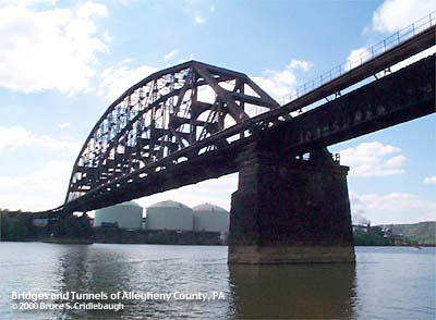
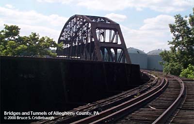
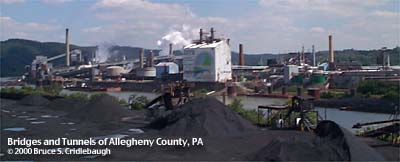
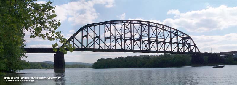
OFFICIAL NAME: OTHER DESIGNATION: Union RR Bridge at Clairton Coke Works mcke596-11 LOCATION: Clairton - Lincoln USGS 7.5" Topo Quad - UTM Coordinates: McKeesport - Zone 17; 0596 4460 CARRIES: Union RR, railroad (abandoned) BETWEEN: -- abandoned PLE RR connection on right descending bank of Monongahela River -- Union RR; USX Clairton Coke Works on left descending bank of Monongahela River CROSSES: -- (RDB to LDB) CSX [PLE RR]; Monongahela River at mile 21.2; Union RR; USX Clairton Coke Works TYPE OF CONSTRUCTION / DESIGN: Parker/Pratt through truss; deck girder and pony girder approach spans LENGTH OF MAIN SPAN: 482.0 ft TOTAL LENGTH (including longest elevated ramp): HEIGHT OF DECK: 47.5 ft, vertical clearance, channel span Lock and Dam No. 2, Braddock, normal pool level 718.7 ft YEAR ERECTED / ENGINEER: c1893; upgraded 1903? ADDITIONAL INFO: Long out of service, this massive railroad bridge could be considered for inclusion into the rails-to-trails system as a possible link to the Montour Trail. The Montour Trail follows the former right-of-way for the Montour RR and is planned to enter the Clairton area along Peters Creek. The truss is wide enough for two tracks, but the deck is in place for only one -- on the upstream side. The rails have been removed from the grade crossing on Lincoln Blvd [Monongahela-Glassport Rd], but the old rails are still found in the wooded area at the base of the cliff on the opposite side of the road. The tracks curve upstream and eventually recrossed the road to meet with the CSX [PLE RR] tracks on the right bank of the Monongahela River. FIELD CHECKED: 03-June-2000 INFO SOURCES: USACE Monongahela River Nav. Charts Submit info or inquiry - share some facts or ask a question. Introduction -- Nearby Structures Page created: Last modified: 15-June-2000 |
View Larger Map 
| ||
| copyright: © Bruce S. Cridlebaugh 1999-2008 All Rights Reserved | ||||