| Home > All By Location regional map > Donora > Sutersville Bridge | ||||||||||||||||||||||||||||||||||||||
|
|
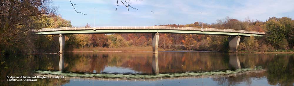
View east (downstream left)
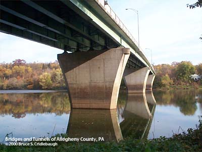
OFFICIAL NAME: Sutersvillle Bridge OTHER DESIGNATION: LOCATION: Elizabeth Twp, Allegheny Co. - Sutersville, Westmoreland Co. USGS 7.5" Topo Quad - UTM Coordinates: Donora - Zone 17; 0601 4455 CARRIES: motor vehicles, two lanes First St [SR2020] sidewalk upstream side BETWEEN: -- First St (Sutersville) on right descending bank of Youghiogheny River -- Douglass Run Rd and Blythedale Rd (Douglass, Elizabeth Twp) on left descending bank of Youghiogheny River CROSSES: -- (RDB to LDB) Youghiogheny River at mile 14.5 TYPE OF CONSTRUCTION / DESIGN: steel deck girder LENGTH OF MAIN SPAN: TOTAL LENGTH (including longest elevated ramp): HEIGHT OF DECK: YEAR ERECTED / ENGINEER: 1986 (see below) ADDITIONAL INFO: Joint project of Allegheny County and Westmoreland County. A bronze plaque affixed to the Jersey barrier facing the sidewalk reads:
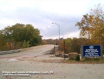
Replaced previous bridge. Stone abutment from western end of previous bridge is adjacent upstream. Sutersville Trail Access for the Great Allegheny Passage bike trail (formerly Youghiogheny River Trail) is at the Allegheny County end of bridge at Douglass Hollow. This area is located at P&LE mile 29.5 which is 14.5 river miles upstream from McKeesport. FIELD CHECKED: 23-Oct-2000 INFO SOURCES: Submit info or inquiry - share some facts or ask a question. Introduction -- Nearby Structures Page created: Last modified: 30-Oct-2000 |
View Larger Map 
| ||||||||||||||||||||||||||||||||||||
| copyright: © Bruce S. Cridlebaugh 1999-2008 All Rights Reserved | ||||||||||||||||||||||||||||||||||||||