| Home > All By Location regional map > Braddock > PRR Port Perry Bridge | ||||
|
|

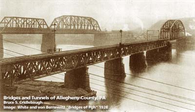
View south from Port Perry, URR bridge at center 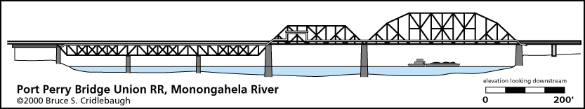
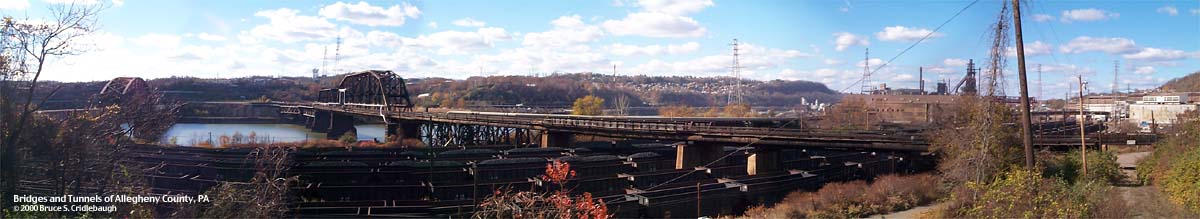
View south from Port Perry, URR bridge at center USS Edgar Thompson Works at far right
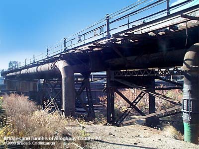
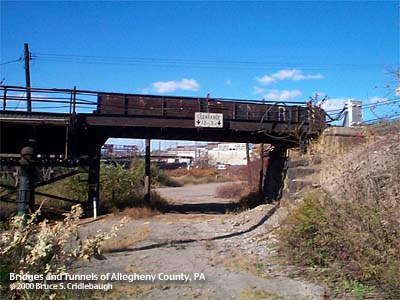
OFFICIAL NAME: OTHER DESIGNATION: Union RR Port Perry Hot Metal Bridge brad597-25 LOCATION: Duquesne - North Versailles USGS 7.5" Topo Quad - UTM Coordinates: Braddock - Zone 17; 0597 4471 CARRIES: railroad BETWEEN: -- north shore of Monongahela River -- south shore of Monongahela River CROSSES: -- (north to south) Monongahela River at mile 11.7 TYPE OF CONSTRUCTION / DESIGN: Subdivided Parker/Pratt through truss; Pratt deck trusses LENGTH OF MAIN SPAN: 378.0 ft TOTAL LENGTH (including longest elevated ramp): HEIGHT OF DECK: 55.2 ft, vertical clearance, at center line of channel span Lock and Dam No. 2, Braddock, normal pool level 718.7 ft YEAR ERECTED / ENGINEER: 1898 ADDITIONAL INFO: FIELD CHECKED: 10-May-2000 INFO SOURCES: USACE Monongahela River Nav. Charts Submit info or inquiry - share some facts or ask a question. Introduction -- Nearby Structures Page created: Last modified: 05-Feb-2003 |
View Larger Map 
| ||
| copyright: © Bruce S. Cridlebaugh 1999-2008 All Rights Reserved | ||||