| Home > Structures Listed by Location - USGS 7.5" topo quad: BADEN | |||
|
|
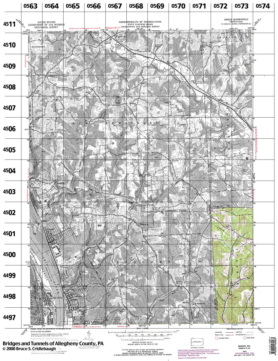
Structures Listed by Location BADEN, PA - USGS 7.5" Topo Quad - UTM grid location in BOLD view map - initial listings completed and fieldchecked 02-Apr-1999
80° 15' 00" W --- 80° 07' 30" W;
0572 4502 - none listed
0572 4501 - none listed
0572 4500 - none listed
0572 4499
view page
- Spang Rd [SB07] over Big Sewickley Creek, near Warrendale Bayne Rd [Red Belt], 1910 concrete arch (Marshall)
0572 4498
- Cliff Rd concrete slab over Big Sewickley Creek at Warrendale Bayne Rd [Red Belt] (Marshall)
0572 4497 - none listed
0573 4502 - none listed
0573 4501 - none listed
0573 4500 - none listed
0573 4499 - none listed
0573 4498 - none listed
0573 4497 - none listed
Submit info or inquiry - share some facts or ask a question.
Page created:
|

| |
| copyright: © Bruce S. Cridlebaugh 1999-2008 All Rights Reserved | |||